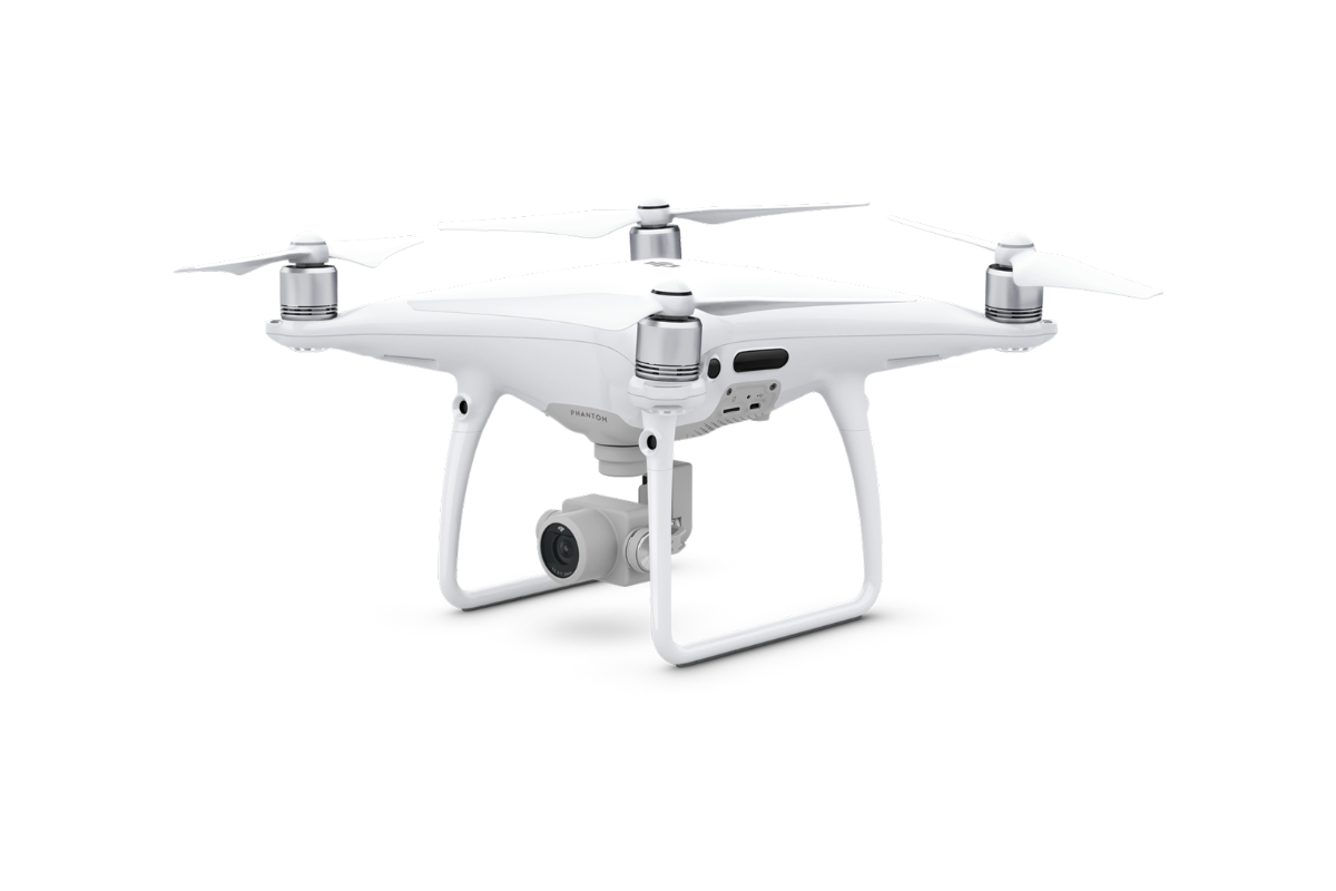
Determination of the Cubic Volume

The service works on the principle of calculating the volume of terrain change based on surveying the terrain before and after the landscaping.
For more information, scroll

Service description

From the measured values, 3D surfaces are created, from the difference of which the cubic volumes are determined. In addition to the two surveyed surfaces, it is possible to work with one surface and compare it to the projected surface – the difference between the actual surface and the projected surface, or a plane with a given elevation value (used in cases where the 1st  condition survey is missing).

Technologies Used

  • Aerial photogrammetry
    We use unmanned aerial vehicles, called drones, for data collection. These are mainly suitable for more precise small to medium scale work or for vertical mapping. We mainly use DJI Phantom 4 Pro and DJI Mavic 2 Pro, which are equipped with a high quality camera with 20 megapixel resolution and high image quality. These instruments can capture images with an image resolution of up to 1cm/pixel.
  • Laser Scanning
    To determine cubic volumes in confined spaces (e.g. tunnels) or spaces unsuitable for aerial photography, we use the laser scanning method. It provides a very high surface surveying accuracy while maintaining high data acquisition speeds.
  • For special purposes, such as measuring small excavation volumes, the MawisPhoto service can be used, see the MawisPhoto Service section.
3D Models
Accuracy
Embankments and Excavations

Advantages of Cubic Volume Determination

  • Possibility of regularly observing surface changes (suitable for landfills, quarries, landscaping)
  • Possibility to control the volume of earthworks during construction
  • At a cost similar to a geodetic survey, it is possible to obtain more detailed and accurate data from the entire site at one time

Outputs Offered

  • Determination of the volume of an object or defined area
  • Determination of differences in the volumes of the object or defined area compared to the design condition
  • 3D surface model:
  • 3D model povrchu:
    o Models of the surface of each of the stages
    o Partial calculations and difference surfaces to the planned state

Technologies used

DJI Phantom 4 Pro

We use this drone mainly for more precise and less extensive work, or for vertical mapping. It is equipped with a high quality 20 megapixel camera with the ability to record 4K videos.

Mobile Phone

Mobile phone for immediate use and documentation of buildings, both their interiors and exteriors. It uses its own video camera/camera to capture a sequence of images and video. The modern electronic MawisPhoto service will then enable the subsequent creation of 3D models.

GoPro Camera

GoPro cameras for immediate use and documentation of buildings, both their interiors and exteriors. Full HD cameras for capturing a sequence of images and video. The modern electronic MawisPhoto service will then enable the subsequent creation of 3D models.

References

Photogrammetry of the Devil’s Stairs

We measured the bottom of the limestone landfill of the big quarry and calculated the cubic volumes of the removal after the drone pass.
More information

Contact Us

Not sure which service is ideal for you? Ask our experts.

Ing. Miroslava Kubíčková

Expert consultant in the field of mapping, LiDAR, photogrammetry, UAV/UAS, 3D models, and BIM
Follow us

Contact Us

Not sure which service is ideal for you? Ask our experts.

Ondřej Hrdlička MTCP (Hons)

expert consultant in the field of mapping, geodesy, photogrammetry and 3D models and BIM
Follow us