Laser Scanning

Fast, accurate, and comprehensive object surveying resulting in a 3D point cloud image of reality.
For more information, scroll

Service description

Laser scanning is a modern method of collecting 3D data of objects of any size at the highest level of detail. The 3D laser scanner collects up to 1 million points per second. The resulting point cloud represents the current state of the object at a given time.

Speed
Accuracy
Objects and buildings

Advantages of Laser Scanning

  • Accurate measurement of objects with minimal deviations
  • Very quick collection of huge amounts of 3D data
  • Comprehensive survey documentation according to reality
  • Fewer additional surveying -> reduced economic costs
  • Surveying in low light conditions or confined spaces

Outputs Offered

  • Point cloud or polygon mesh
  • Drawing documentation of objects (passport)
  • Documentation of the actual construction (DSPS)
  • Detailed 3D models of objects
  • Building Information Model (BIM)

Technologies used

Geoslam ZEB REVO RT

Mobile laser scanning system for use especially in the building interiors. It uses a combination of laser scanning and SLAM (simultaneous localisation and mapping) technologies.
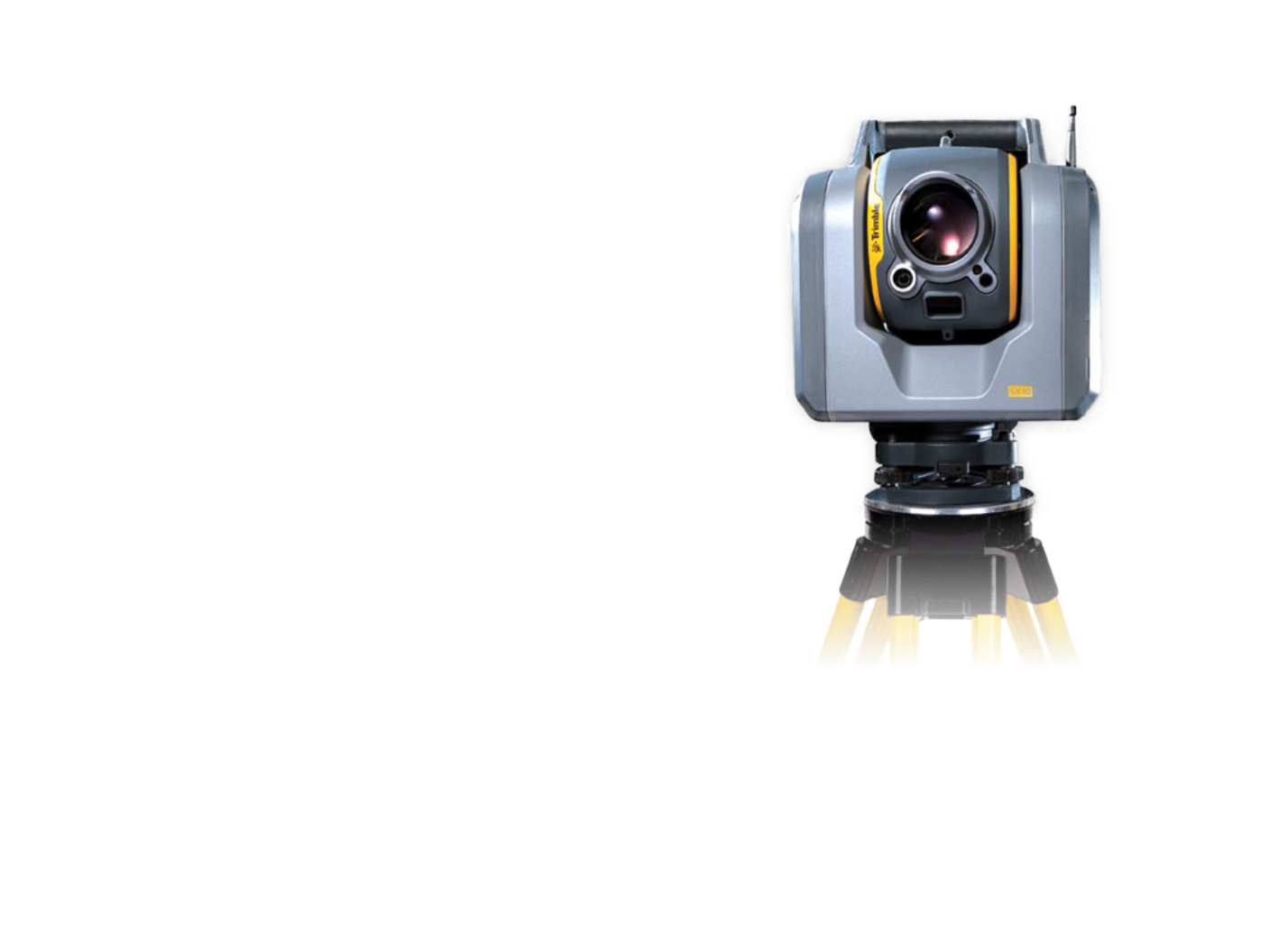
Trimble SX10

The scanning total station is an innovative solution in the field of mapping, engineering, and surveying worldwide, setting new standards for surveying instruments.

FARO Focus M

The FARO Focus M Laser Scanner is a powerful high-speed static laser scanner designed specifically for short distance scanning applications in confined spaces.

References

Residential building in the center of Prague

We mapped a residential building with a floor area of about 2500 m2.
More information
2 500 m2

Pasportization of Čiper's Villa

We have prepared a passportisation of the Čiper Villa in the form of a BIM model.
More information

Hranice and Jezernice viaducts

We have created 3D visualizations of historical buildings.
More information

Scanning of VHV Towers

We performed a detailed laser scan of the VHV towers to complete the documentation.
More information

Railway Station Building Scanning

The project deals with the construction documentation of the railway station buildings in Čáslav, Prostějov.
More information
Area: 1 800 m2 (Čáslav), 1 680 m2 (Radotín), 3 700 m2 (Prostějov)

Railway Tunnels

Update of documents for the planned reconstruction of the Tanvald – Kořenov railway section.
More information
Area: 7 375 m2

Production and Storage Hall

We created a BIM model of the production and storage hall.
More information
Area: 7 500 m2

Family House

We have created a 3D model of a family house in Ústí nad Labem.
More information
1 100 m2

Passportisation of Bridges and Culverts for the Road ŘSD

We have prepared a passportisation of bridges and culverts in the form of BIM models.
More information

Water Treatment Plant – Vír dam

We have created a BIM model of the area around the Vir dam.
More information
12 500 m2

Contact Us

Not sure which service is ideal for you? Ask our experts.

Ing. Miroslava Kubíčková

Expert consultant in the field of mapping, LiDAR, photogrammetry, UAV/UAS, 3D models, and BIM
Follow us

Contact Us

Not sure which service is ideal for you? Ask our experts.

Ondřej Hrdlička MTCP (Hons)

expert consultant in the field of mapping, geodesy, photogrammetry and 3D models and BIM
Follow us